Colorado Water Resources

Share

A few months ago I did some research and wrote some blog postings about hydroelectricity in Colorado. I had been asked by my friend, Bevan, whether we were failing to take advantage of the hydroelectric power that was available from the rivers in Colorado simply because of the political issues associated with damming our beautiful river canyons. In doing this research, I found that we do, in fact, harvest some of the hydro power and, due to the fact that the flow rates of these rivers are not large or consistent, we would not really gain much power generating capacity even if we extracted all of their theoretical hydroelectric energy.

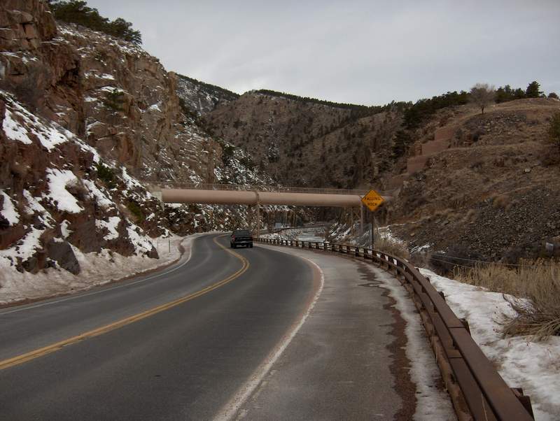
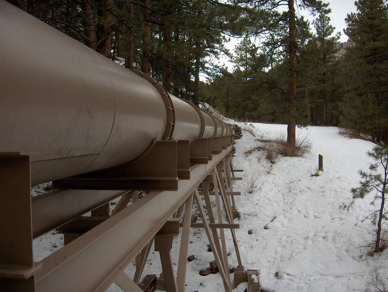
One of the most fascinating public projects I read about during my hydroelectric research is the Colorado Big Thompson water diversion project. Using a series of tunnels, pipes, canals, reservoirs and pumping stations, this project collects and diverts water from west of the continental divide and brings it to the eastern slope. About 70% of the population of Colorado lives along the Front Range, yet 70% of the precipitation falls on the western side of the continental divide. The C-BT project provides about 213,000 acre feet of water to the eastern slope each year. Nearly all of this water has its energy extracted through a series of electric generating stations with a combined capacity of 162 MW. That’s enough electricity for about 80,000 homes. It also provides enough water for about 425,000 homes. To put it in perspective, the C-BT project delivers more water to the Front Range than both the Big Thompson and Cache la Poudre rivers combined.

An acre-foot of water is about 326,000 gallons. Each household in Colorado uses about .5 acre feet per year which about 13,600 gallons per month. This is about 30% more than the national average, which is due to the need to irrigate our lawns. Colorado has a very dry climate and in order to have a lawn and shrubbery, they must be irrigated. It made me wonder how much water we use for things that are essential compared with uses those that are not essential, such as growing lawns.

A general rule of thumb is that each person in the U.S. uses about 50 gallons of water per day. You can estimate your daily consumption by visiting a USGS site and using their calculator. The calculator uses the following values for personal water consumption:

  • Bath: 50 gallons
  • Shower: 2 gallons per minute
  • Teeth brushing: 1 gallon
  • Hands/face washing: 1 gallon
  • Face/leg shaving: 1 gallon
  • Dishwasher: 20 gallons/load
  • Dishwashing by hand: 5 gallons/load
  • Clothes washing (machine): 10 gallons/load
  • Toilet flush: 3 gallons
  • Glasses of water: 8 oz. per glass (1/16th of a gallon)

Another way measure your household’s water consumption is to look at one of your water bills from a winter month. I found that our water consumption comes out very close to the estimate of 50 gallons/person per day. The real shocker for me was looking at a summer water bill and comparing it to a winter water bill. Our summer water consumption goes up by a factor of 10! For about 4 months out of the year we need to run the sprinkler system and its water consumption dwarfs the amount of water for personal use during those months. Overall, watering our lawn for those 4 month accounts for more than 65% of our annual water consumption!

I began to wonder what this is costing us so I began to study our water bills. Interpreting utility bills is not always easy. There are sometimes so many charges that it’s hard to tell what drives the overall cost. I had to call our city’s water department to figure out how the charges are computed. In the case of our water bill, there are three charges. The first is for the storm sewer, which is based on the size of the property. The second is for the regular sewer bill, which is determined by water consumption during a winter month to eliminate the effect of irrigation water, which doesn’t return to the sewer. The last is the cost of the water used based on a meter reading to measure actual water consumption. Included in the water charge is a flat connection charge, which is around $8/month. When you combine the two sewer charges of $18 with this $8 charge my water bill is already at $26/month before I’ve purchased my first gallon.

The cost per 1000 gallons of water in Greeley is $2.41, which is about the average in U.S.. That’s up about 40% from what we were paying 6 years ago, so it’s been increasing faster than inflation. For those of you in other countries who measure water in cu. meters, there are about 264 gallons per cu. meter.

I visited the manufacturer’s web site for my sprinkler system and found out that each 360-degree sprinkler nozzle uses about 3 gallons per minute. The quarter and half nozzles use proportionally less water per minute. I have 9 sprinkling zones each with a total of about 5 “360-degree equivalent” heads, so when I’m watering my lawn, I’m using about 15 GPM. My watering cycle takes 3 hours so that comes out to 2700 gallons. At the $2.41/1000 gallon cost, it costs about $6.50 each time the sprinkler cycles. We’re restricted to 3 days a week that we can water the lawn, so that adds about $80/month for watering the lawn in the summer time. Now that I know how much each watering costs, I’m being more vigilant about using the timer’s ‘rain’ button to suspend watering when we’ve just gotten some rain. I’ve even been looking at the weather forecast to see if it makes sense to skip a cycle if rain is predicted.

Sometimes people have asked if we can do something more intelligent when it comes to watering lawns, such as using ‘gray water’, i.e., the water that would normally be sent to the sewer and directing it to water the lawn instead. That might work for water that is lightly contaminated such as water from a shower or dishwasher, but there is no easy way to separate that from the other contaminated water that you (and your neighbors) wouldn’t want on your lawn. We also need to consider that waste water from inside the house is eventually treated and put back in rivers where it can be used downstream. Also, now that I know that it takes 10 times as much water to keep the lawn green as the amount we need for personal use, I can see that recycling gray water would hardly put a dent in one’s overall water consumption.

How about collecting rain water from the roof and other surfaces and storing it? In my case, only about a third of our 1/2 acre lot has grass on it. The rest is covered with impervious surfaces like the house, concrete patios, the driveway, and landscaping rock. If it were possible to capture the rain water, would this work to offset or even eliminate a watering bill? I did the calculations and there does appear to be enough precipitation that falls on this lot (about .5 acre-foot per year) to supply all of our watering needs. However, to store and treat this water would not be practical. A single lawn watering takes 2700 gallons which comes out to 8000 gallons per week. Since it can sometimes go for weeks without any significant rain during the summer, we’d likely need a 20,000 gallon storage tank to store $50 worth of water. Then you have to consider that it would take chemicals to keep it from turning into a bacteria pond and it’s easy to see why cisterns have never proved to be very popular when tap water is available. There are even laws about capturing one’s own rain water in Colorado since water rights and property are separate and so it is against the law to capture and hold your own property’s rain water. Here’s an article about water harvesting in Colorado that contains more information about it.

The other option is
xeriscaping which means having a lawn with plants that can survive with no supplemental irrigation water. However, this is not always possible and the attractiveness of this approach will no doubt vary with the eye of the beholder. My friend Peter lives in a subdivision where the covenants require the residents to have a certain percentage of green grass in their lawns. Some people say that they love the look of natural desert, but to be honest, it’s only beautiful at a distance. The natural ground cover on Colorado’s Front Range is mostly noxious weeds full of pointy things that will pierce your skin. There is not much attractive about what grows on Colorado’s Front Range naturally. Most people think of Colorado as beautiful mountains filled with Aspen and pine trees. That all starts about 30 miles to the west. Most of us live on the plains.

The availability of water is starting to limit growth in this area and if we get a serious drought, it will likely cause a further restrictions on new growth. The new water tap connection fees are already in excess of $14,000 per home in Greeley.

People like living in dry climates because it’s almost always sunny and there’s very little humidity. But we all need water to survive and to create an attractive environment. We all like having green grass and shade trees nearby. We have plenty of land in Colorado for future growth, but not enough water to support unrestricted growth. Every gallon of water I conserve will likely get used up by some new construction project that is enabled by the water’s newfound availability. It’s quite a dilemma about what to do when it comes to water conservation. Everyone wants to do their part, but if the reward for it is more growth and more people, then that takes some of the incentive out of it. We could grow the population of Colorado until we’re all walking around in stillsuits, but what good would that be?

Having said that, I do realize that certain industries like construction depend on new growth to survive. I hate to be like the people who, once they have found a promised land, put up a no trespassing sign and tell everyone else to stay out. That’s not an uncommon sentiment to hear people express in this area. The city of Boulder has had an anti-growth policy for many years. Everyone wants to be the last one in.

Colorado is somewhat unique among the dry western states because we have areas in the state that get in excess of 50 inches of precipitation per year and areas that get less than 10 inches per year. Most of the areas where people live get between 10 to 15 inches per year, which is not enough to grow much more than cactus, thistles, and tumble weeds. To put it in perspective, states east of the Mississippi get between 40 to 50 inches of precipitation per year and it’s quite consistent throughout the region. When you get over about 40 inches per year, it’s usually not necessary to irrigate one’s lawn. In Colorado, most of the high precipitation areas are the mountain peaks, which tend to hold the precipitation throughout the winter in the form of snow and release it gradually during the spring runoff. This runoff is captured in a number of reservoirs and used during the dry summer months for residential, commercial, and agricultural use. It’s a very delicate balance that requires carefully matching the supply with the demand.

The problem with precipitation is that it is local and seasonal. In other words, it’s difficult to match the amount of precipitation you get with where you need it, when you need it. And that problem is compounded in states like Colorado where the population and seasonal effects of precipitation are not matched very well. We need to be very resourceful about how we collect, distribute, and use the water resources we have. And one must not underestimate the beneficial environmental impact of paving corn fields and constructing strip malls in their place, an activity that has continued unabated in Colorado over the past decade.

That leads me to my last observation. Is agriculture on a high desert plain an intelligent use of land and water? I’m sure that for people who are involved in farming that they’d consider it to be the most beneficial use of the land. They’ll no doubt maintain that attitude until someone offers them several hundred years’ of annual farming profits for the property to construct a residential neighborhood or a strip mall on the land. In the case of high density living where one builds apartments, this would definitely qualify as a net water savings. Irrigated crops in this region take about 1.3 acre-feet of irrigation water per acre on the average, whereas if you put about 12 people on that acre, it would take less than half of the amount of water, especially if you pack them in so that you don’t have much lawn to water. If you pave the parking lot and streets around the neighborhood, all the better, because the water that falls on it can be collected and used elsewhere. Similarly, virtually all the water that crops use evaporates, but most of the water people use gets treated and put back in the river just a few miles away, so it can be used downstream. I do realize that water that evaporates will eventually get recycled, but unlike a river, it’s a lot harder to maintain claim to it once it goes into the sky.

So it would appear that for every acre of agriculture we give up, we can jam another 12 residents into Colorado. Then all we need to do is find some jobs for them.

Colorado Hydroelectric Power part 3

Share

To wrap things up, I wanted to provide a short chronicle what is most likely the earliest instance of hydroelectric power in Northern Colorado.

Nearly 100 years ago the Fall River hydroelectric plant was built by F.O. Stanley just northwest of Estes Park, CO. Stanley is best known for developing the Stanley Steamer automobile. Stanley came to Estes Park in 1903 at age 54 when he was suffering from tuberculosis. His doctors thought that the dry mountain air would be beneficial for him. It must have worked because F.O. Stanley went on to recover from TB and fell in love with Estes Park and decided to move there permanently. He ended up living into his 90’s and left his mark on the town. Today you can see the luxurious Stanley Hotel perched up above the north side of the town. It’s become quite a tourist attraction in its own right. One of the hotel’s most notable distinctions is that it was the inspiration for Steven King’s famous book The Shining.

Stanley recognized that the hotel would need electrical power so he took it upon himself to construct a hydroelectric plant utilizing the Fall River which exits Rocky Mountain National Park at the Fall River entrance. This river meets with the Big Thompson in Estes Park and then goes on to Estes Lake which is formed by the Olympus Dam. The Fall River plant is about 3 miles northwest of town very close to the Rocky Mountain National Park Fall River Visitor’s Center.

The Fall River hydroelectric plant was built in 1909, the same year as the hotel, and had a Hug Water Wheel powering a 200 kW GE generator. It was initially intended just to power the hotel in the summer months but residents of the town also wanted to have electricity so Stanley agreed to sell it to them. Within a short time, the generator was no longer large enough to supply a growing population. Stanley decided to use a coal-powered steam plant at the hotel to free up some of the Fall River plant’s capacity for the town’s residents. He also replaced the penstock that was fed by Cascade Lake with a larger diameter pipe. Cascade Lake is located about a mile upstream and is 400’ higher in elevation than the plant.

In 1921, a second unit was added, a 900 HP Worthington Francis turbine powering a 680 kW GE generator which only ran from May through September when the river flow was sufficient to supply the power.

The plant was augmented with diesel generators several times and ownership was passed from Stanley to the Public Service Company and eventually to the Town of Estes Park who owns the plant today. The Lawn Lake Flood of 1982 damaged the plant and penstock and today it no longer produces any electricity but is instead run as a museum. You can read much more about its history and how to find it here.

My wife loves to gift shop up in Estes Park and I usually accompany her and follow her around from store to store as she searches for just the perfect gifts. I don’t think you’ll find a higher density of gift shops anywhere in the world than you will in Estes Park. I enjoy the scenery while traveling there and back, but next time I think I’ll take my own little side excursion during the shopping activities and tour this hydroelectric facility.

Colorado Hydroelectric Power part 2

Share

After my last posting on Colorado Hydroelectric power, I got a comment related to the fact that there were several hydro plants on the Big Thompson River. I started to do some more research eventually culminating with a visit to canyon yesterday to do some firsthand investigation on the subject.

There are actually two hydro plants situated on the Big Thompson River. One is part of the Colorado Big Thompson (C-BT) project and is located down by the mouth of the canyon near the Dam Store. It’s called the Big Thompson Power Plant and was accounted for in my last posting. It is the smallest of all the C-BT generating plants (4.8 MW) and is only operated during the runoff season from May through September. There is a dam just upriver from it, but the water from that dam is not used to power it. Instead, it is powered by a penstock with 180’of head that comes from the Charles Hansen Feeder canal. The canal runs across Highway 34 via an inverted siphon. That’s the pipe you see when you enter the canyon.

This is the 4.8 MW Big Thompson hydro plant. The large overhead structure is a crane for servicing the generator.

The water in the Charles Hansen Feeder canal can be augmented with the Big Thompson River by a diversion dam located about a mile up the canyon. This small dam feeds water into the Dille tunnel which goes through a mile of solid rock to meet up with the Charles Hansen Feeder canal just south of the inverted siphon. You’ll notice that the pipe is quite a bit lower than the open canal sections that run on either side of it. I’ve included a Google Earth 3D perspective of this phenomenon. I never understood what that pipe did until I flew over it and then it was like a lightbulb going off in my head. I suppose an aqueduct that ran across the canyon at the canal elevation would have cost much more to construct than this inverted siphon. The Charles Hansen canal is used to fill Horsetooth Reservoir with C-BT water.

The Big Thompson power plant’s penstock is formed by a rectangular concrete chute that runs down from the canal on the south side of the highway 34 and is piped under the highway and over to the generating station. In addition, some of the canal water can be simply dumped into the Big Thompson River depending on how they want to move flow along the C-BT project.

This is the inverted siphon that crosses Highway 34. The canal is about 100′ higher than this pipe.

This is a Google Earth 3D view of the mouth of the Big Thompson canyon. You can see that the Charles Hansen canal is much higher in elevation than the pipe that crosses the highway. The power plant water inlet comes from the top of the canal on the left side of the canyon.

I spoke yesterday with a very nice woman from the Bureau of Reclamation by the name of Kara Lamb who posts frequently to a forum sponsored by Mountainbuzz. This forum is monitored by white water kayakers with rapt attention to check flow rates on the Big Thompson River. That way they know when it’s time to ditch work and do some kayaking. Flow rates are changed periodically to send water to where it’s needed and so the volumetric flow can vary unpredictably and thus is important for kayakers to check the forum to see when the water levels are suitable for kayaking. Kara is very knowledgeable about the C-BT project and in the course of one of her postings, she mentioned another power plant on the river owned by the city of Loveland. The power plant she referred to is the Idlewilde Hydro Plant located in Viestenz-Smith Park. This power plant is fed via a penstock from the Idlewilde Reservoir which is located about 2 miles upriver from the plant. The plant is very easy to overlook because it’s not very big and there is not much equipment around it to suggest it’s a power plant. It could easily be mistaken for a maintenance building.

I found in searching around that there was a trail that ran up the canyon on the opposite side from the park called the Foothills Nature Trail that was said to have a few exposed sections of the penstock, which is otherwise buried for the 2 mile distance it runs to the Idlewilde reservoir. I hiked this trail yesterday and took a picture of the metal pipe. It is 3’ in diameter and was originally made of wood back when it was first constructed in 1920’s.

A small exposed section of the Idlewilde Dam-Power Plant penstock. It runs 2 miles, mostly underground from the reservoir to the power plant and can carry 74 cfs of water.

I couldn’t find any information regarding the amount of water flow through the penstock or generating capacity of the Idlewilde plant on the Internet so I went to the park and found some posters that explained a little more about its tumultous history and other interesting facts. The generators inside the building were rated at 900KW which is enough to supply electricity to about 900 homes. Back in the days when the only use for electricity was lighting, this hydro plant could supply a substantial portion of Loveland’s electricity needs.

At 900KW, the Idlewilde hydroelectric plant much smaller than any of the hydro plants that are part of the CB-T project. But since it is not a technically a part of the C-BT project, there is no information about it on the C-BT web pages. The entire facility was completely wiped out in the Big Thompson flood of 1976 and the remnants of the 3 original generators are on display in the park. In the 1980s, the plant was rebuilt and the generators were replaced
with 2 turbines with the same generating capacity. The generating station subsequently returns all the water it receives from the penstock to the river just downstream from the hydro plant.

I also found on the Bureau of Reclamation website that my estimate of 50% for the capacity factor may be too high for several of the C-BT power plants, particularly the Big Thompson Power Plant since it only operates from May-Sept each year. Thus, its capacity factor is only around 20% of its 4.8MW nameplate value. I think that when the river flow is low like it is now in January (~20 cfs), only a portion of the rated power could be generated by the Idlewilde plant. In other words, a 74 cfs diversion flow from the Idlewilde Dam could not be sustained in the winter months and thus it would have to run at reduced capacity. But I was able to hear the generators running, so it appears to be generating at least some electricity year-round.

In talking with Kara, she mentioned that there have been various proposals to add hydro capacity over the years, such as at the outlet of the Olympus Dam in Estes Park, as well as the outlets of Carter Lake and Horsetooth Reservoir. However, these never seem to move forward due to their economics. They just wouldn’t generate enough power to cover their construction and operating expenses.

The more I research the C-BT project, the more impressed I am with the engineering and foresight that went into it. In addition to augmenting the water supply on the Front Range with more capacity that the Big Thompson and Poudre Rivers combined, the designers did an excellent job at extracting all of the available hydro power from the water with minimal environmental impact. It’s hard to fathom that much of the project was implemented more than 60 years ago.

My conclusion is still the same as my original assessment, that is, since now I know that 2 miles of the interior of the Big Thompson canyon essentially has its hydro power harvested to produce less than 1MW of power, the total capacity of the 20 mile stretch of canyon would account for no more than 12 MW of generating capacity which is certainly not enough to justify the environmental impact or economics of pursuing it.

Colorado Hydroelectric Power

Share

My friend Bevan asked me recently why we don’t see more hydroelectricity projects being developed. I replied, “All available hydroelectricity that can be developed has already been developed”, hoping it didn’t sound too much like the unfortunate 19th century quote attributed to Charles Duell about how everything that can be invented has already been invented. Despite my interest in renewable energy, I had not thought very much about hydroelectric power since I have long assumed that if someone could have built another dam on any existing waterway and placed a generating turbine at the bottom of it, it would have been done decades ago.

Bevan responded, “Well, how about the Big Thompson River which flows unimpeded down a canyon for many miles and has no hydro generating stations along it?” I began to wonder if we had been avoiding employing a source of clean and renewable energy simply because of its environmental impacts, as often seems to be the case. I thought, “If the Big Thompson canyon could be dammed, how much hydroelectric power could it produce?” Please note I’m not suggesting that anyone actually do this. It’s one of the most naturally beautiful and accessible canyons in Colorado and even if it could supply enough energy to solve the entire world’s energy needs, it probably still would never be approved due to opposition by those who would like to keep the canyon and river in their natural states. I am just trying to satisfy a curiosity I have.

Often times, putting up dams on rivers is resisted even more vehemently by environmentalists than constructing fossil fuel-burning plants. The concerns range from the people who are displaced by lakes that are created by the dams to fish species that can no longer reach the river’s head waters to breed. Dams have some other benefits such as flood and drought control, but those may be overshadowed by the safety concerns of a dam breaking and causing flooding and destruction. So despite its environmentally-friendly electric power generation, hydroelectric power has other environmental impacts that can limit its acceptance.

A few months ago I took a clean energy class through CSU. One of the classes met at the offices of the Platte River Power Authority, a co-op power company that supplies electricity to the cities of Fort Collins, Loveland, Longmont and Estes Park. The PRPA gets about 20% of its power from hydroelectricity. While touring the grid control facility, I saw a lot of generating stations on the large control board. Among them were several hydro generating stations located west of Fort Collins. I realized that I had somehow overlooked these generating stations in my travels, although I’m sure I had driven by them or flown over them on many occasions. Upon doing some research into the topic, I found that the hydroelectric generating stations monitored by the PRPA are powered with water that is diverted from the western slope. Through a series of tunnels, canals, and siphons, nearly all of the 260,000 acre feet of water diverted annually from the western slope has its energy converted to electricity by a series of power hydroelectric generating facilities, most of which are easy to overlook.

The means to divert the water from the western slope is called the Colorado Big Thompson (C-BT) Project. It is one of the largest and most complex natural resource developments ever undertaken by the Bureau of Reclamation. There are more than 100 structures comprising this project which you can read about here.

The most important part of the project is the Alva B. Adams tunnel that directs water from Grand Lake on the western slope to the eastern slope of the Rocky Mountains. The tunnel is 13 miles long and goes through solid rock under the continental divide. The water eventually finds its way into several large man-made reservoirs, the largest two being Carter Lake and Horsetooth Reservoir which are situated in the foothills along the Front Range. Prior to arriving at these reservoirs, the water flows through 5 hydroelectric generating stations. I’ve listed them and their capacities in this table:

Generating Station Penstock Head (ft) Capacity (MW)
Mary’s Lake 205 8.1
Estes Park 482 45
Pole Hill 815 33.25
Flatiron 1055 71.5
Big Thompson 180 4.5

Unlike many of the hydro generating stations you find on large rivers, the ones that are part of the Colorado Big Thompson Project are small stations located at the end of long pipes called penstocks, which are large diameter tubes connected to the upstream water source.

Energy contained in water is proportional to both the water’s pressure and flow rate. This energy is converted to electric power through a turbine-generator. Available water flow is usually dictated by nature by the region’s snowfall and rainfall. Pressure, however, can be adjusted. To increase the pressure, it’s necessary to increase the depth of water, also known as its ‘head’. Water pressure increases about 1 psi per 2.3 foot of head, and as a result, you can see that the generating stations with the higher penstocks in the table above produce much more power. One way to get more pressure is to construct a very tall dam. Another way is to construct a relatively shallow dam and put the generating facility at lower elevation and connect the dam and generating station with a penstock. You need to constrain the water in the penstock that runs downhill to the generating station which has the effect of greatly increasing its pressure. Sometimes these large diameter pipes are buried, and other times they are exposed. You can see them exposed in several places in Colorado Big Thompson Project, such as above and below Mary’s Lake just south of Estes Park. There you can see a long sections pipes running down a mountainside. At the bottom of the upper penstock, you’ll find Mary’s Lake generating station. A similar penstock runs partially underground and partially above ground from Mary’s Lake to the east side of Estes Lake, where you will find Estes Park generating station.

I am missing one C-BT power plant in my list above because it is located on the western slope, a 21.6 MW generating facility on the Green M
ountain Reservoir. Although it is technically part of the C-BT project, I didn’t include it because I was interested in figuring out how much power is generated from this diversion project from water flow to the east side of the continental divide. I was also curious about how much water flowed to the east side of the continental divide through the tunnel and how it compared with the normal Big Thompson River flow. In other words, just how much water do we import from the western slope?

Wikipedia lists the average flow rate of the Big Thompson River to be 72.5 cu. ft/sec where it exits the Big Thompson Canyon. The Alva B. Adams tunnel can handle a flow rate of 550 cu. ft/sec. It runs at about 84% capacity on an annual basis which means that it has an annual average flow of 460 cu ft./sec. I was very surprised by this number. This means the tunnel provides more than 6 times as much water flow as the Big Thompson River provides on an annual basis.

The total maximum generating capacity of the 5 hydro plants that I’ve listed in the table is 162.5 MW. A reasonable capacity factor for hydroelectric generating plants is 50% so we can assume that the average annual generating capacity of these stations is about 81 MW or 710 million kWh per year.

So, where am I going with all this? I’m trying to figure out how much energy could be obtained if we were to convert all the flow of the Big Thompson canyon using several large dams or a series of smaller dams with penstocks connected to generating stations. Based on the differences in flow rates between the Big Thompson River and the diverted flow through the Alva B. Adams tunnel, which is a factor of 6.4 greater, I would estimate that the amount of power available from the Big Thompson River would be around 12 MW, again assuming a capacity factor of 50%. I figure that the head of each flow is the same, and thus the flow rate difference means that the Big Thompson would generate about 16% (1/6.4) of the capacity of the C-BT generating stations if it were to all be converted to electricity. That’s enough to power 12,000 homes. This sounds like a lot, but to really put it in perspective, this is only around 2% of the capacity of a typical fossil fuel generating plant. For example, the Rawhide Power Plant north of Fort Collins which is a coal/gas plant can generate 522 MW. The Fort St. Vrain power plant south of Greeley which uses natural gas can generate 720 MW. Nuclear plants typically have capacities of 1000 MW or more, with the largest one capable of generating more than 8000 MW. When you talk about power in those quantities, 12 MW seems like a drop in the bucket.

It would appear that the amount of power available from the Big Thompson River is so small as to not make it worth the investment even if there were no environmental concerns. The construction costs would be quite substantial, considering the impact to the region such a project would cause. It would require moving many homes and businesses as well as the highway that runs through the canyon.

Rivers in the Colorado are much smaller than the ones you find in the eastern and pacific northwestern parts of the United States. In fact, based on flow rate, they would probably only qualify as creeks in other parts of the country. On the lower section of the Susquehanna River in Pennsylvania, there are 3 hydroelectric dams in a span of 21 miles that combine to generate more than 1,000 MW of hydroelectric power. But with an average flow rate of 40,000 cu ft/sec, the Susquehanna River has 500 times the flow of the Big Thompson River.

The largest hydroelectric generating project in the world is currently under construction in China. The Three Gorges Project will have an output of 22,000 MW and will thus qualify as the largest electrical generating plant in the world of any kind. It’s not without its environmental impacts, however. Nearly 1.4 million people had to be moved in order to fill the lake behind the dam. I suppose eminent domain may work a little differently in China than it does in the U.S.. I can’t conceive of any public works program that could displace people on that scale in the U.S. or any other country for that matter.

Hydroelectric power is one of the oldest and largest sources of renewable energy available today. Its output doesn’t vary as much as other renewable energy sources like wind or solar. It even offers the potential for energy storage to allow for peak demand-shifting. However, I don’t think that it can be expanded significantly from its current state, except perhaps in a few geographies around the world that are underdeveloped by western standards.