

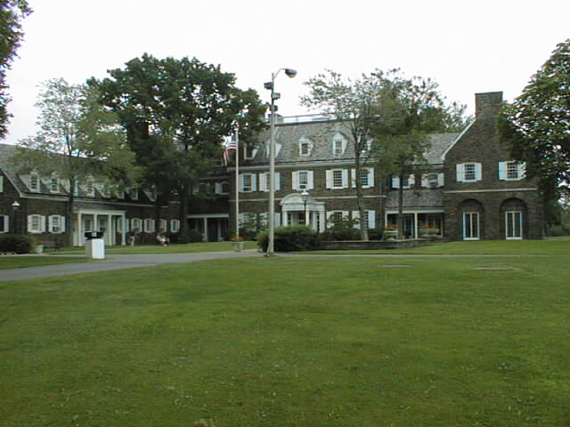
During my first year at Penn State’s Wilkes-Barre campus, I took a physical education class called orienteering. The PSU Wilkes-Barre campus is located near Lake Lehman, PA in a rural, wooded area surrounded by fields and farms. The main building on the campus, called the Hayfield House, was previously a country estate that has been converted into classrooms and offices. The campus is visually breathtaking.
The orienteering class required us to use a topographic map and a compass to find a series of flags hidden in the surrounding woods and copy down numbers from them. It was essentially a timed race to see who would find them all and get back to the starting point in the shortest time. It was great exercise, because you covered a lot of terrain in a short time and it had an element of fun to it because you had to think at the same time you were running. Plus, it was all outdoors in a beautiful setting. I still have many fond memories of exploring the countryside around the PSU W-B campus during that class.
A few weeks ago during one of our regular neighborhood walks, Terri and I found a couple looking for something using a GPS. I asked them if they were geocaching and they told me they were attempting to find their very first geocache. I had heard about geocaching a few years ago from my friend Kyle, but I had never seen anyone doing it. We helped them for a few minutes, but we didn’t find the cache. GPS units are accurate to about 30 feet, and so it can sometimes be a challenge to find a small geocache, especially if it is well concealed. I learned later from a geocaching website that they eventually located it. It was knowing that they found it that convinced me to give it a try.
GPS signals were not always so accurate. Or, I should say, they were not so accurate for civilian GPS receivers. At one time, civilian GPS receivers were only accurate to about 300 feet. The military intentionally added random noise to the GPS signal which only military receivers could remove. On May 1st, 2000, the Clinton administration turned off this random noise, called ‘selective availability’, and over night civilian receivers had their accuracy improved 10 fold. The removal of SA along with the availability of inexpensive handheld GPS receivers and geocaching websites has made geocaching possible.
The brief description of geocaching is that someone hides a cache, which is usually a weatherproof container. The cache can be as small as a bullet-sized container or as large as a metal ammo box. The person who hides it posts the container’s GPS coordinates on a website that contains a database of geocaches. The first and largest of these websites is geocaching.com which was started in 2000. It contains the locations of more than 500,000 caches around the world. The person who hides the cache includes a ‘log book’ in it to let those who find it log their username along with the date and a comment. In the small containers like the ever popular 35 mm film canisters, (which are usually covered with camouflage tape), the log is just a small scroll rolled up inside. Some of the caches contain trinkets and, if you’re so inclined, you can take a trinket and leave one of your own. There are also some special serialized tags and coins that are unique to geocaching that you can move from cache to cache and the website can keep track of the object’s whereabouts. Each cache has a unique identifier that starts with the letters ‘GC’. The subsequent characters are assigned by the website at the time the cache is registered. The person hiding the cache usually gives it a clever name and possibly a clue to help locate it. When you set up an account on geocaching.com, you select a unique user ID and you are able to log your discoveries of the geocaches. The geocaching.com website accounts are free, but you can also get a paid account for $3/month that has more features.
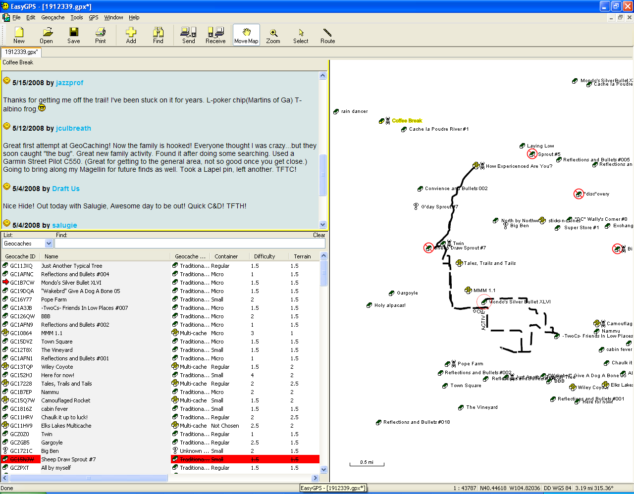
The website allows you to download the cache coordinates to your GPS which is a great convenience. I downloaded a free program called EasyGPS and that will take a file of geocache locations and put them on my Garmin eMap GPS. You can enter the coordinates by hand too, which is what I did for the first few caches, but it takes much more time to do that and can be a source of error.
Inside the city of Greeley, CO which has a population of around 87,000 people, there are more than 70 caches hidden. Some of them are elaborate ‘multicaches’ which have clues in them so that you may have to find 3 or 4 caches before you can find the coordinates to the main cache. Some even have quizzes based on subjects like math or history that makes finding the final cache that much more challenging. Within a 10 mile radius of my home, there are nearly 200 geocaches hidden.
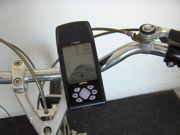
Terri and I have been looking for caches lately and we’ve managed to find 14 just in the area where we take our regular walks. I’ve put a GPS handlebar mount on my bicycle and now that we’ve found most of the caches within easy walking distance of our house, I’ve been planning to venture out to find the more of them on the bicycle and to get some exercise in the process.
People who like to work with technology can spend an inordinate amount of time indoors, often sitting in front of a computer. Geocaching requires you to get outside, get some exercise, and do some exploring. If you have a GPS, I’d recommend you give it a try. Will you feel funny doing it? Oh yes, you’ll feel like an idiot at times, especially if there are any ‘mugglers’ in the area. A muggler is a non-geocacher who will stare at you and make you feel odd, and who among us can’t use a little more of that? You’ll get to learn a whole new language too, such as abbreviations that you will put in your on-line log like ‘SL’ (signed log), and ‘TFTC’ (thanks for the cache), and ‘TNLN’ (took nothing left nothing), and it’s hard to put a price on knowing an obscure lingo like that. 🙂
Hi Lee,
A few things,
1. GPS signals ARE intentionally inaccurate to civil receivers during war time, like right now.
2. What was the best/coolest cache you have found thus far?
I’d love to get involved. I’ll be getting reimbursed part way for my new bike, so maybe I’ll spend that money on a GPS receiver for my bike.
Chris
Hi Chris,
There are 6 unintentional sources of GPS inaccuracies that have to do with things such as ionospheric propagation effects, ephemeris errors of the satellites, and even atomic clock inaccuracies. They account for the 10 meter accuracy range of a typical GPS receiver. The military always has the option of turning on SA again, but it’s probably a moot point. If someone wants to send a pin-point accuracy missile, they can set up an improvised transmitter in the target area and correct not just the SA dithering, but also some of the other inaccuracies to get the bomb delivered to within 3 feet of a target.
As for the coolest caches, I’d have to say they are the ammo boxes. They are almost always off the beaten path, or otherwise they’d be ‘muggled’ (stolen and/or vandalized) and because they are so large and weatherproof, they can fit a lot of cool stuff in them. The things you find in a geocache are generally more interesting to the younger geocachers, usually the things like little toys. I am more likely to view a geocache as a way to give away something I no longer need to someone else who might consider it to be a perfect gift. 🙂
I also like the cleverly concealed geocaches. For instance, I was looking for one for about 5 minutes and I knew I was close and then when I was ready to give up, I noticed a sprinkler head in the ground. But there weren’t any plants or grass around for 50 feet. Sure enough, someone had turned a sprinkler head into a geocache! I was almost the FTF (first to find) it, but someone had beaten me to it by a few hours.
As for the ‘perfect’ geocaching GPS receiver, it seems that the handheld Garmins are the most popular. On the geogaching forums, about 90% of the people are using them and/or recommend them when someone asks which GPS they should purchase. I have 3 Garmin GPS receivers myself. My oldest one is an aviation model that is 14 years old, as unbelievable as that sounds. I got it at Oshkosh in 1994. Another is the Garmin eMap I’ve been using for geocaching. I got it around 1999 and it is shown in the blog posting. The newest one, which I won in a poker game, is a Garmin c340 Street Pilot. The Street Pilot is my most modern GPS and it even has a USB interface which makes downloading coordinates very easy, but you can’t enter waypoints by hand and that makes it nearly useless for geocaching because the multi-caches require you to do that. Automotive GPS’s tend to be quite restrictive because they are targeted at a single application.
I also have two PDAs that have GPS’s. One is an HP iPaq hx4700 with a Leadtek bluetooth GPS receiver I picked up in Taiwan and the other is an HP rx5900 Travel Companion that I got for having a paper accepted at a conference that has its own built-in GPS.
After considering all these GPSs for geocaching, the only one that works for me is the eMap, but it’s not ideal. It looks like I need to do another blog posting on geocaching to talk about the relative merits of each device and what I’d do if I were just starting out and had to choose a GPS specifically for geocaching.
Thanks Lee,
I have a store near me hat sells ammo boxes, so those aren’t too interesting to me, but those may be useful.
I looked on the geocache website, and there are only a few caches around me, right now. Only a few are within biking distance for me (10-20 miles each way.
Anyway, I might just get a cheap RX and go from there, maybe.